Miles Today: 265 Total: 4,630 miles
A long and beautiful drive today through an area of unimaginable catastrophe that left behind an area of fantastic beauty. It is remarkable to me that this is not more on the tourist trail, it is truly a wonder of the world.
First though, we had breakfast on the patio in Leavenworth and bid a yodelling farewell to that pretty town.


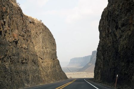
Back we drove through the apple orchards to the Columbia River and turned north up Rt. 2, an area of great coulees – ravines – running at right angles to the huge river valley.


Then the road turned east over a huge golden high plateau dotted with remote farm buildings that had probaby been there for 150 years. Very remote, I can’t imagine what it must have been like to live there before the age of the car. There were tiny pioneer cemetaries along the way which probably told their own story.
As we approached Banks Lake, which is a dammed extension of the Columbia River, we turned right onto Rt. 17 for the Dry Falls and Sun Lakes State Park. We had already had an amazing view of the astounding canyon from a viewpoint a couple of miles back.


The visitor centre was a couple of miles along Rt 17 from the turn. We caught an excellent presentation from a ranger who explained – with video and projections – how the geology of the area worked. It is simply astounding.


To summarise, and I am not a geologist, so this is as I understood what was presented there. In the last Ice Age, the ice cap came down over what is northern Montana and Washington with ice cover at a depth of up to a mile. A lobe of ice at least a half-mile high blocked the Clark Fork River near the present-day Idaho and Montana border, creating an enormous natural reservoir – glacial lake Missoula. The water level rose to about 2000 feet behind the ice dam.
Around 18000 to 15000 years ago, the ice started to retreat and pressure built up causing the ice lobe to fail. This released a terrifying flood, unimaginable in scale. A huge volume of water – 600 cubic miles, the volume of Lake Ontario and Lake Erie combined was suddenly released, completely emptied in the space of 2 days. The wall of water – at times 800 – 1000 feet high raced westward at speeds of 65 miles per hour, sweeping away everything in its path, spreading over 16,000 square miles of land, through present day Montana, Idaho, Washington and Oregon until it reached the Pacific Ocean. This catatrophic event happened over and over again over the next 3000 years. As soon as Lake Missoula emptied, the ice lobe would start to form again, and it would fail again….The waters scoured the landscape, creating deep craters through the volcanic basalt that had formed in previous millenia.
Imagine the roar of the water as it advanced. The power of the event was more fierce by many times than the most powerful atomic bomb ever released. Dry Falls was created by these catastrophic events, forming a waterfall 3.5 miles wide and with a drop of at least 400 feet. At times the water depth rushing over the top of this would be close to 300 feet. So…. the largest waterfall in the world by many times. It probably only lasted a short time, every time the ice dam burst. The flood washed away everything in its path, leaving behind rocky coulees and canyons all the way to the Pacific. Debris deposited into the Pacific. Isolated rocks dropped hundreds of miles from where they’d been plucked by the river.
Around 13000 years ago, warming caused the glaciers to retreat north and the rivers retreated leaving the Falls and the Coulees dry, as they remain now. You can read more about the catastrophic flooding here https://www.historylink.org/File/8449 and there is a very excellent presentation with videos and storyboards here https://wadnr.maps.arcgis.com/apps/Cascade/index.html?appid=84ea4016ce124bd9a546c5cbc58f9e29

We were stunned by the scale of these floods, so unimaginably huge. The sort of thing that was featured in the film “2012” which seemed fantastical – tidal waves washing across the India for example – actually happened.
We headed north up Rt 17 to Steamboat Rock State Park. The road ran along the long lake ie the Columbia again, with a steep canyon to our right. It was a spectacular drive through canyonlands. Eventually Steamboat Rock appeared in front of us a huge basalt rock, 800 feet high and just linked to the mainland by a narrow causeway. It was a beautiful state park that we stopped at for our lunch. These state parks are so well laid out. There is always a camping area with plots laid out and a day use area. There will be a large park area with picnic tables and little bbqs. All sorts of facilities. At this one there were boat launches, a fish cleaning station….. They really are a great facility for everyone and very well used.


We continued on to the Coulee Dam and then turned SE on Rt 2 and picked up Rt 231 after Reardon, cutting off the need to go through Spokane and picking up Rt 2 again. We passed through Newport and crossed the Washington border into Idaho.
Our stop for the night is at Priest River at the Eagle’s Nest Motel. It’s a lovely little place with great views over the Priest River. Oddly enough, it is themed around bears, not eagles. We had a sundowner in there gazebo next to the apple orchard looking down to the beehives on the river bank. Very tranquil. Nice after a day trying to imagine catastrophe and deluge!


